
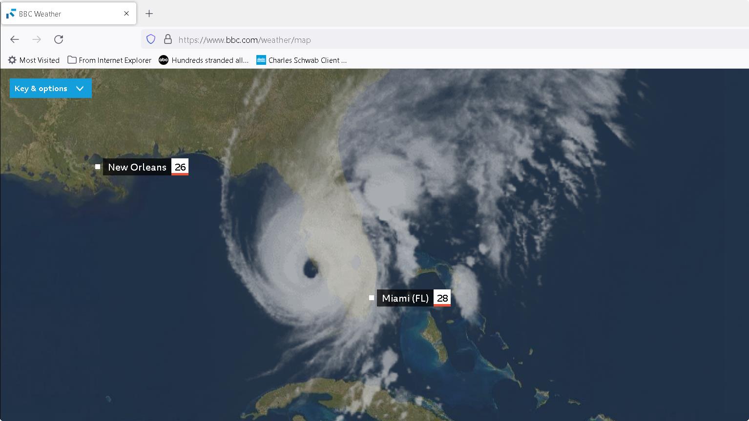
After monitoring the storm for a week, Hurricane Ian finally made landfall over Sanibel Island and then Fort Myers, in SW Florida on Sep. 28, 2022, approximately 2:00 pm EST. Click the satellite image below to see animation, 24 images – 5-minute update.
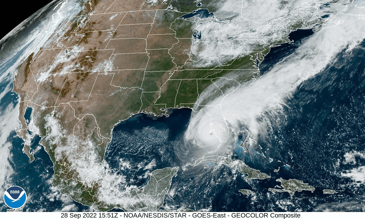
GOES-East CONUS – GeoColor – NOAA / NESDIS / STAR
Notice the eye of the storm forming
NWS Southern Region Tropical Webpage (weather.gov)
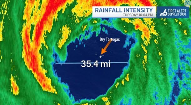
The eye of Hurricane Ian over the Dry Tortugas on Tuesday, Sept. 27, 2022.
Hurricane Ian Forms New Eye as It Approaches Florida: John Morales – NBC 6 South Florida (nbcmiami.com)
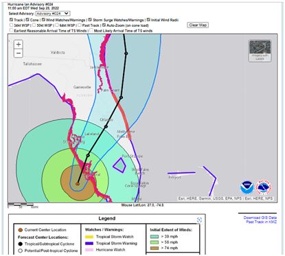
9/28/2022, 2:00 pm, Hurricane Ian, a strong Category 4, almost Category 5, with around 155 mph wind speeds, moving north-northeast at 9 mph.
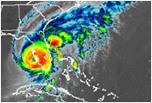
We have been monitoring Hurricane Ian and preparing the worst scenario to protect our property at same time since 9/21/2022. There were many so called spaghetti models presented by the news media. Major model, GFS model, Global Forecast System, was shifting to west every day for sometimes. Another computerized model, Euro Model, European Center for Medium-Range Weather Forecast had been consistent to make landfall on the west coast of Florida.
It took days for the two models to finally agree that the where on the west coast the storm would make landfall.
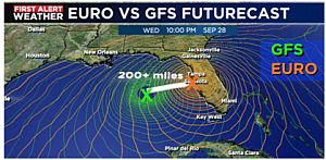
EURO Model was originally 200+ miles east of the GFS Model prediction
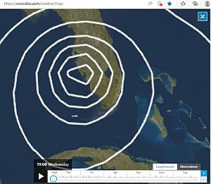
EURO Model on BBC weather website, landfall position note this site provides time GMT
We were lucky this time. Tropical storm-force winds of 36 miles per hour and over 8 inches rain in some locations of St Lucie County reported 12:00 am, Wednesday, 9/28/2022.
Important storm tracking links:
https://www.nhc.noaa.gov/ National Hurricane Center
https://www.bbc.com/weather/map EURO model, European Center for Medium-Range Weather Forecast
Port St Lucie, FL hurricane | Microsoft Weather (msn.com) Port St Lucie Hurricane web site
NWS Southern Region Tropical Webpage (weather.gov)
https://arcg.is/195nuP0 Florida evacuation map
Florida Power Outages Map Provides up to date power outages through out the state
Hurricane & Tropical Cyclones | Weather Underground (wunderground.com) Weather underground for severe weather